Another Speed Bump on the Way to Spring
Tuesday, March 8, 2022 - 6:45 A.M.
Daylight Saving Time begins this weekend and Spring arrives a week later at 11:33 A.M. EDT on Sunday, March 20th. Although we have seen generally milder temperatures recently, Winter isn’t done with us yet!
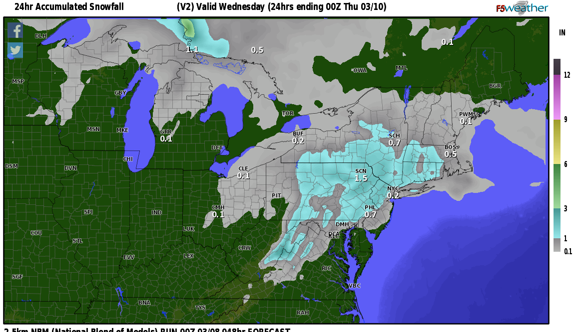
Low pressure will move out of the southern states Wednesday, into the mid-Atlantic region, then move off shore and pass to the southeast of New England Wednesday night. This system will bring snow to southern and central New England Wednesday. The current timetable brings the precipitation into parts of Connecticut during the morning commute Wednesday, with snow reaching southern Vermont and New Hampshire by lunchtime. Temperatures will likely rise into the 30’s, above freezing, in many places Wednesday, so the snow may mix with some rain at times, however I am anticipating mostly snow from this system, with most of the region receiving between 1”-4” of accumulation by the time the precipitation ends Wednesday night. Total liquid-equivalent (melted) precipitation amounts will be mostly between 0.25”-0.50”. Areas of ice will form Wednesday night as temperatures drop below freezing.
I am primarily basing my snowfall estimates on a compromise between the National Blend of Models and High Resolution Ensemble forecasts show below. Because of the marginal temperatures and higher sun angle this time of year (radiation still gets through the clouds), there is a better chance of approaching the higher amounts across the higher elevations and in general, the snow will likely accumulate more readily on grassy surfaces. I wouldn’t rule out the possibility of some of the low elevations, down near sea level, having trouble even accumulating a full inch because of too much mixing with rain and/or temperatures that are a tad too mild.


