Arctic Air + Moisture = Snow & Ice For Millions During the Next Few Days
Tuesday, February 1, 2022 - 9:55 A.M.
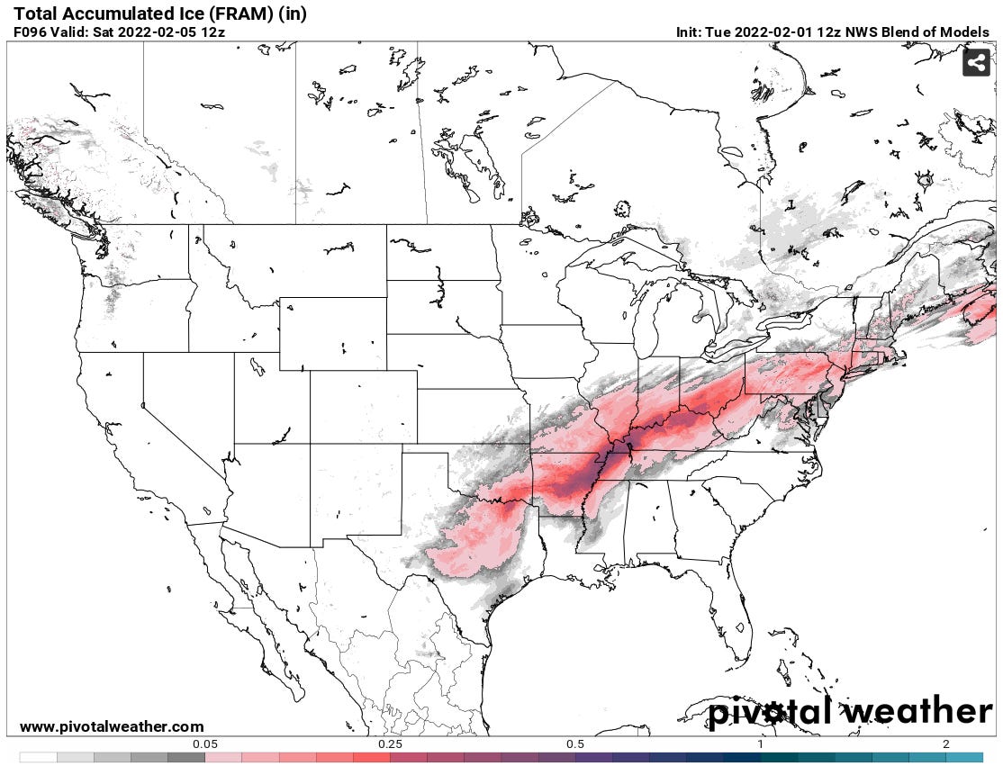
Arctic air moving down from Canada is going to rendezvous with moisture lifting out of the Gulf of Mexico. The two will meet along a frontal boundary in the middle of the country that will already have precipitation along it. A couple of waves of low pressure riding up, along this front will enhance the precipitation Thursday & Friday. The result? A wide swath of snow accumulating between 8”-16” is likely from central Missouri, Illinois, and northern Indiana, over to northern Ohio and southeastern Michigan, the northwest corner of Pennsylvania, the northwestern half of New York and northern New England, not to mention adjacent areas of Ontario and Quebec Provinces. A band of ice from freezing rain and sleet will like develop from central Texas, northeastward, into the Ohio Valley, and parts of the northeast.

Take the forecasts below with a grain of salt, but they give a feel for areas likely to be affected and an idea about amounts.
Winter Storm Warnings currently extend from Liberal, Kansas to St. Louis to Chicago, Kalamazoo, Michigan, and Cleveland. Winter Storm Watches have been issued from Midland, Texas to Oklahoma City to Little Rock, Arkansas, northeast through Indianapolis, Indiana and Lexington, Kentucky to Columbus, Ohio, Syracuse, New York, and St. Johnsbury, Vermont.


