


Spring Fling Gives Way To Winter Storm
Thursday, February 24, 2022 - 8:05 AM

After setting record high temperatures across the region yesterday (including 71 degrees at BDL!) Winter has returned this morning with temperatures in the teens and 20’s. A winter storm will be impacting us late tonight and Friday. A low pressure center will move out of Kentucky and along the Ohio/West Virginia border overnight, reaching a position near Pittsburgh by 7 AM Friday. Meanwhile, a second low will be taking shape south of Long Island. This secondary development will allow enough cold air to remain locked in to result in a messy morning commute across the region Friday.
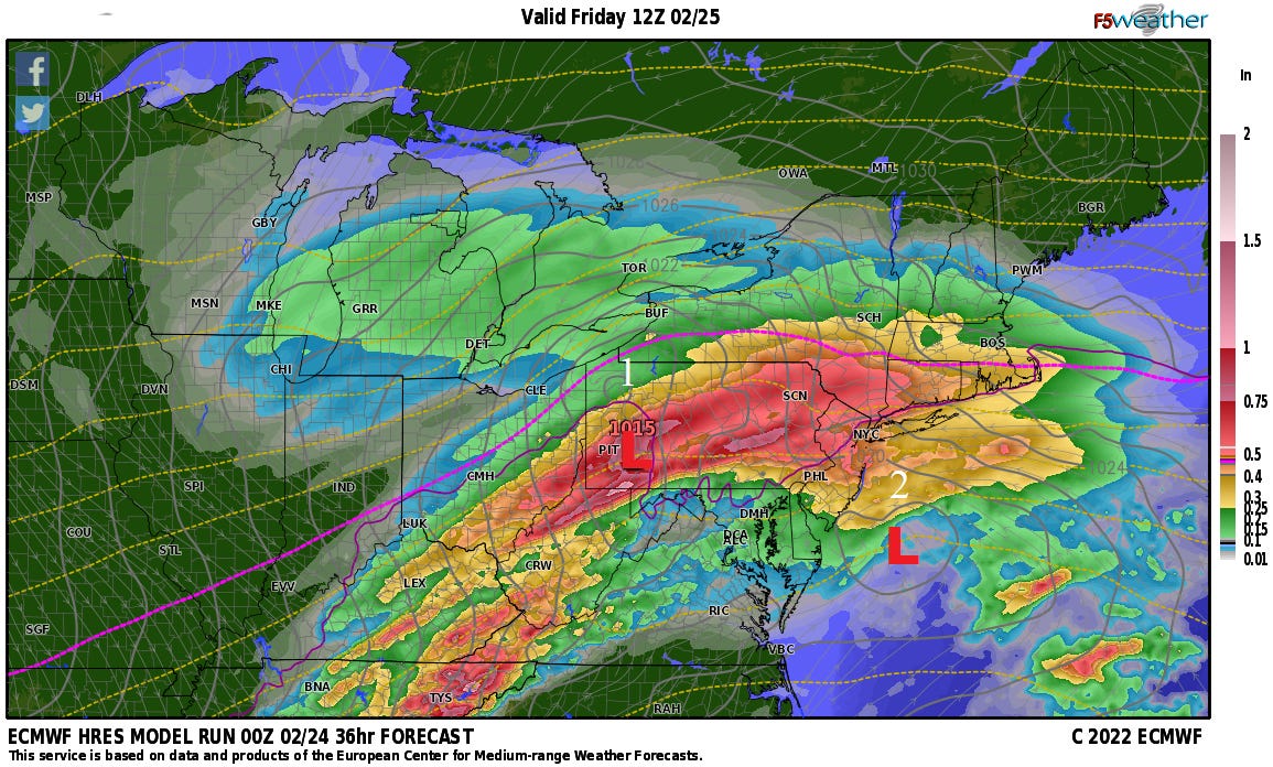
Across most of southern New England snow will break out after midnight tonight. Once it gets going the snow will come down at a rate of 1”-2” per hour. There may be some brief mixing with sleet in places shortly after the start before all levels aloft cool below freezing, however the real change from snow to sleet will occur between about 5:00 A.M.-10:00 A.M. from south to north across CT, RI, and southeastern MA. Some areas of freezing rain and plain rain will also mix in during the morning and early afternoon, with the precipitation tapering off in the afternoon. Forecasting snowfall amounts is a bit tricky because with the snow coming down at rates of 1”-2” per hour, if the changeover to sleet occurs, say 2 hours earlier or later than forecast, it will decrease or increase accumulations by 2”-4” in either direction (a 4”-8” swing). At this point I am expecting to see accumulations between 2”-6” across the southern half of CT, RI & southeastern MA, 4”-8” across the northern half of these areas, 6”-12” across western MA (where there will be less mixing), and 12”-18” across the Green Mountains of Vermont. These amounts can easly change if the forecasted temperature aloft changes by a degree or two.
thanks bob, hear you in the am!!