A low pressure center will track from near Chicago today to near Ottawa late tonight. The northwesterly track will pull unseasonably mild air into New England. Cloudiness will increase and thicken across the region today with a couple showers arriving by this afternoon. The bulk of the rain will fall this evening and tonight, then taper off during the predawn hours. High temperatures this afternoon will range from 50-55 across southern New England, to the 40’s in Northern New England (except for some 30’s in northern Maine). A southerly breeze will pick up this evening and tonight, keeping temperatures from falling much. Clouds will linger into Wednesday morning but the sun should be out by afternoon. (Some towns may see a brief shower when the cold front arrives Wednesday afternoon). Temperatures will pop into the 60’s across southern New England, possibly flirting with record highs, while the North Country sees highs in the 40’s & 50’s.
Wind speeds will decrease late tonight into early Wednesday bit pick up again by Wednesday afternoon behind the cold front. Much colder air behind the front will send lows Wednesday night/early Thursday down to the 20’s across southern New England and single numbers and teens up north. The colder air will prevail through Thursday into Friday, setting the stage for a winter storm.
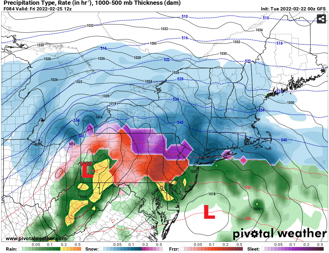
Low pressure will move out of the Ohio Valley and into Pennsylavania Friday, followed by a secondary low taking over south of New England. This series of events will result in snow developing late Thursday night (after midnight), continuing into Friday. It appears that enough above-freezing air will intrude aloft to cause the snow to change to mixed precipitation in parts of southern New England Friday. The Friday morning commute is likely to be slower than normal. At this time I’m thinking that snowfall accumulations will generally be in the 3”-6” range across Connecticut, Rhode Island, and southeastern Massachusetts, with 6”-12” more common across central and northern portions of New England, where little or no mixing is more likely. These numbers will change through, if the likely northern extent and timing of the changeover from snow to mixed precipitation changes between now & then.


